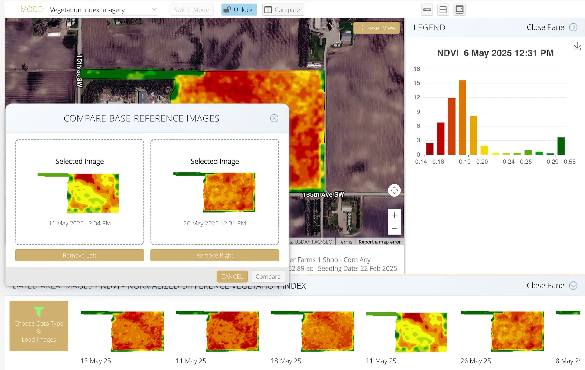
Vegation Imagery - Available in 6 styles

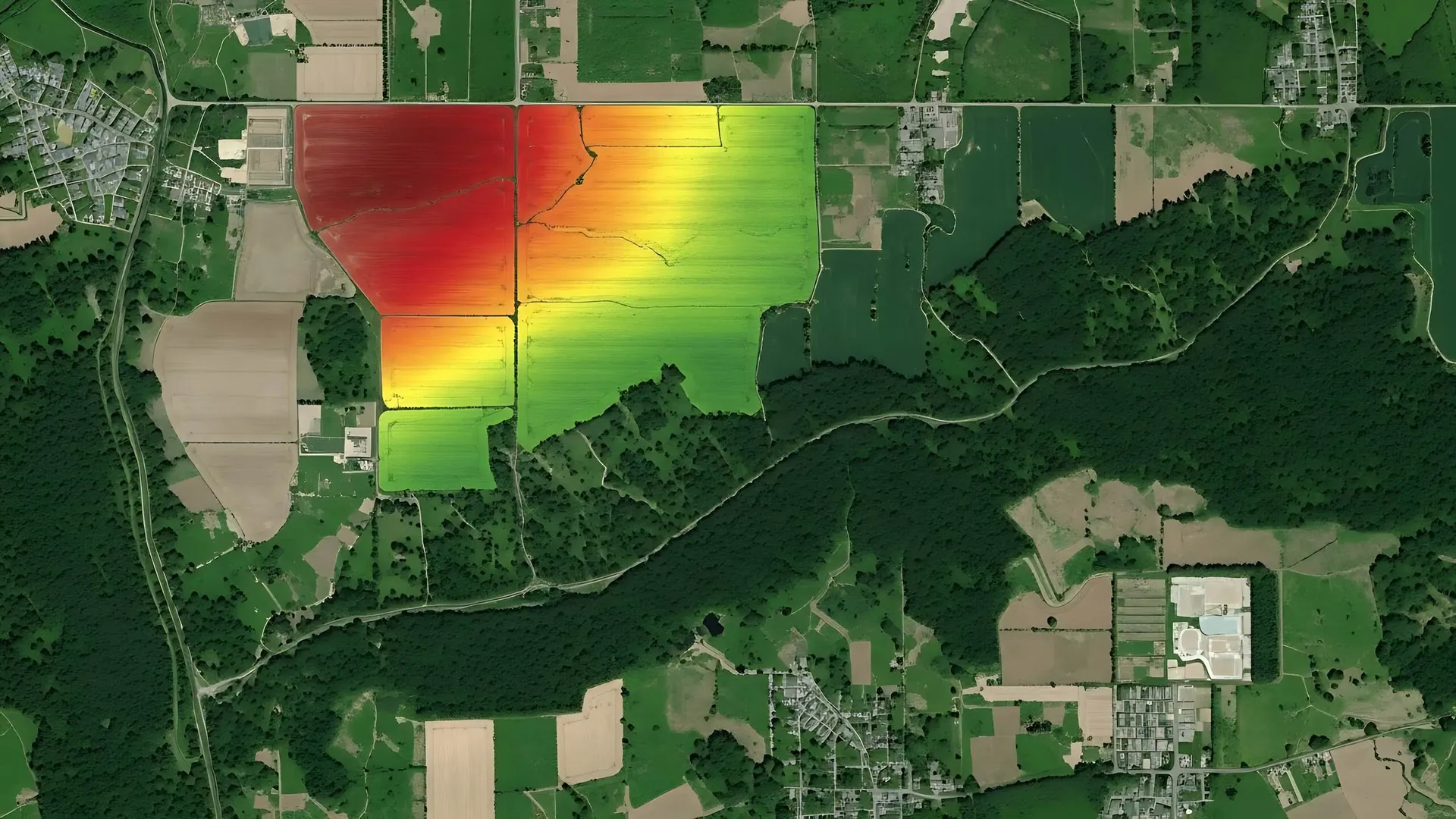
In March 2026, agCOMMANDER released a dedicated Crop Analytics module built on integration with EarthDaily. This extends precision-farming capability with high-quality earth observation data, supporting stronger in-season visibility, risk reduction and operational planning.
EarthDaily describes its platform as space-age data and analytics built for agriculture, delivering AI-ready satellite data and near real-time change detection that can be transformed into practical management insight.
Learn more: Platform API | Digital Agriculture | agCOMMANDER press release
Variable Rate Prescription (Rx) maps are part of agCOMMANDER's core precision-farming and mapping capability, not limited to a single imagery provider. Management zones can be created manually, imported from other sources, or generated via EarthDaily and then used in the same VR workflow.
In other words, EarthDaily is an advanced input into the generic agCOMMANDER Management Zone + Rx engine. Contact us for a walkthrough of Management Zones and Variable Rate workflows.
Vegation Imagery - Available in 6 styles
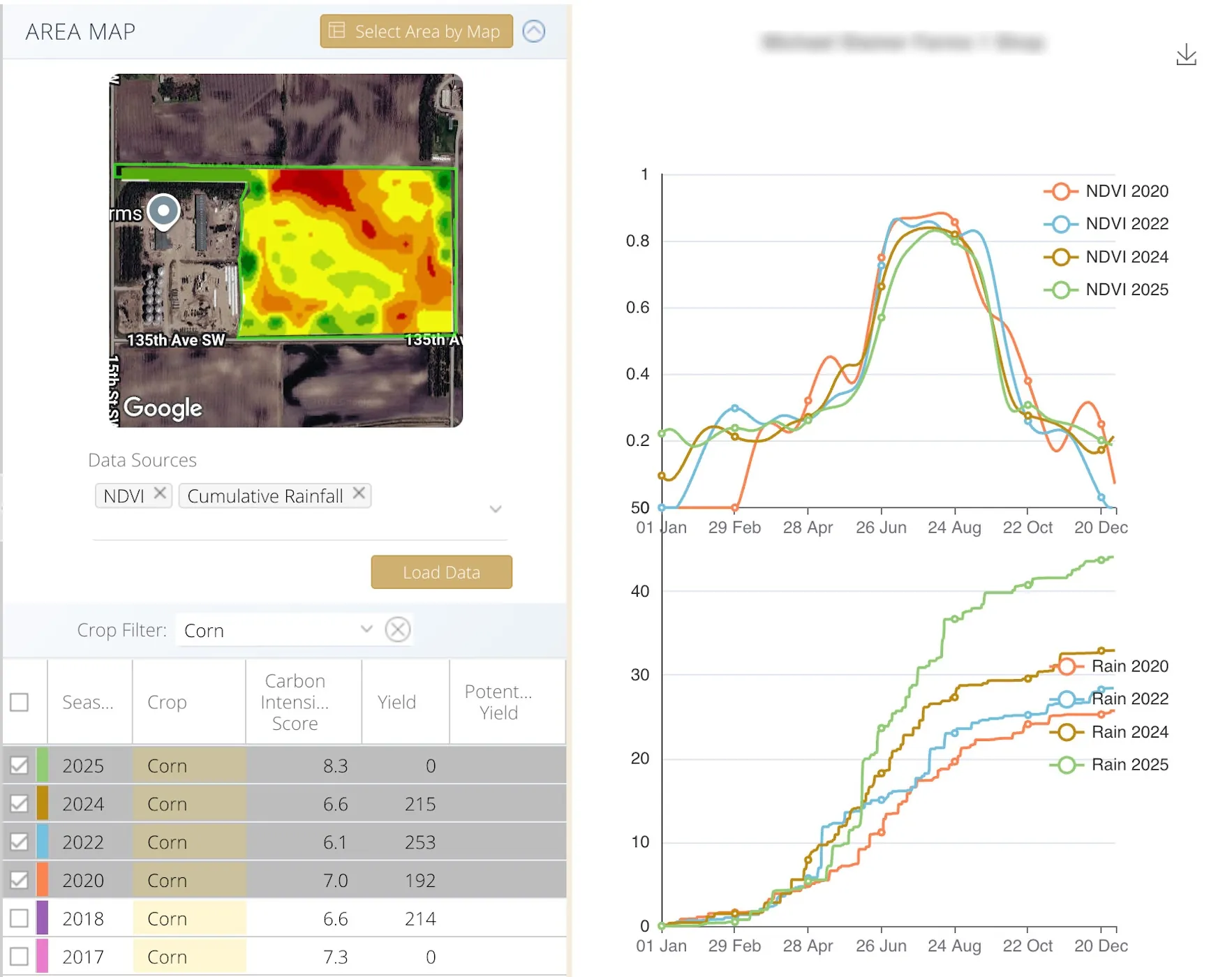
Time Series Charts - Helping to predict season outcomes
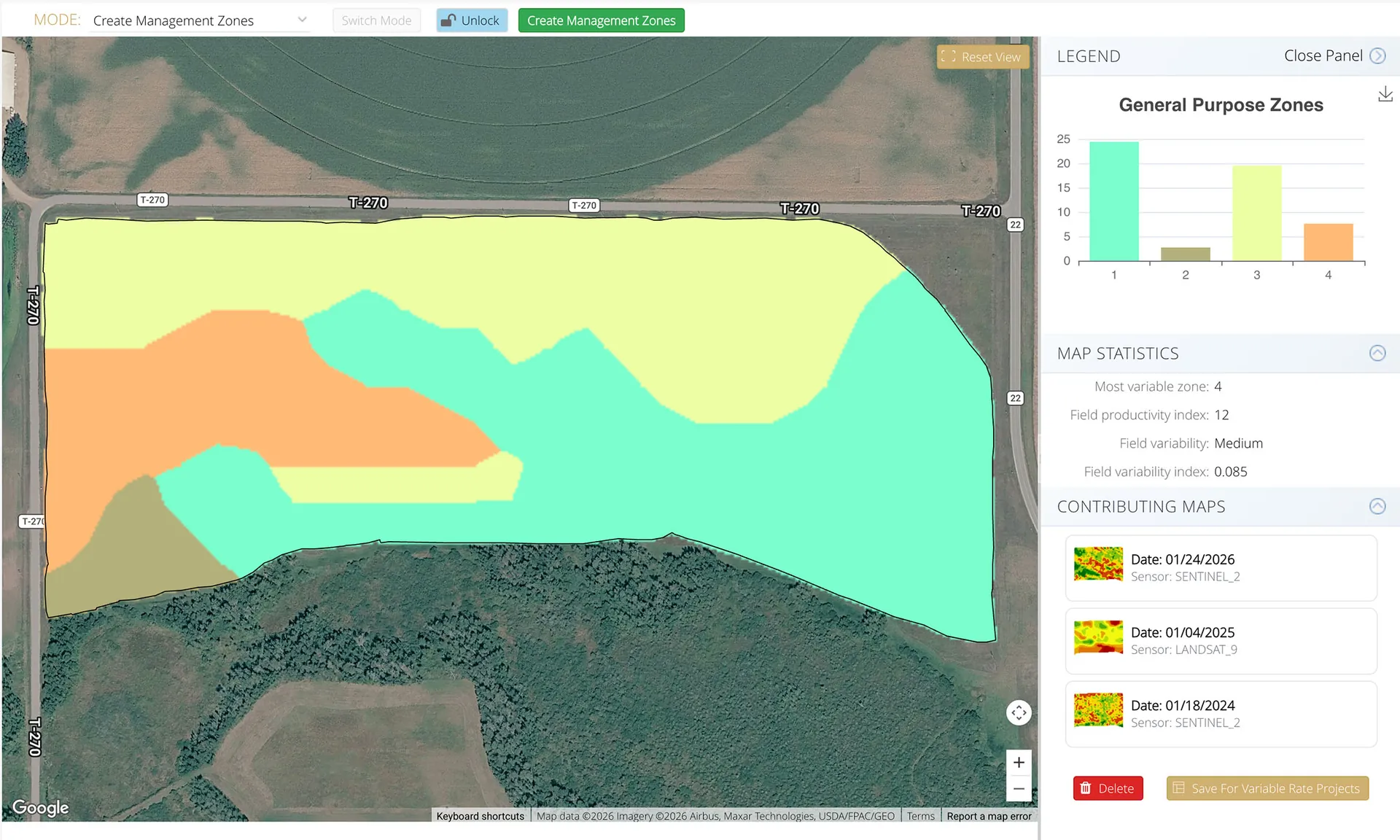
Creating Management Zones for Variable Rate (Rx) Maps
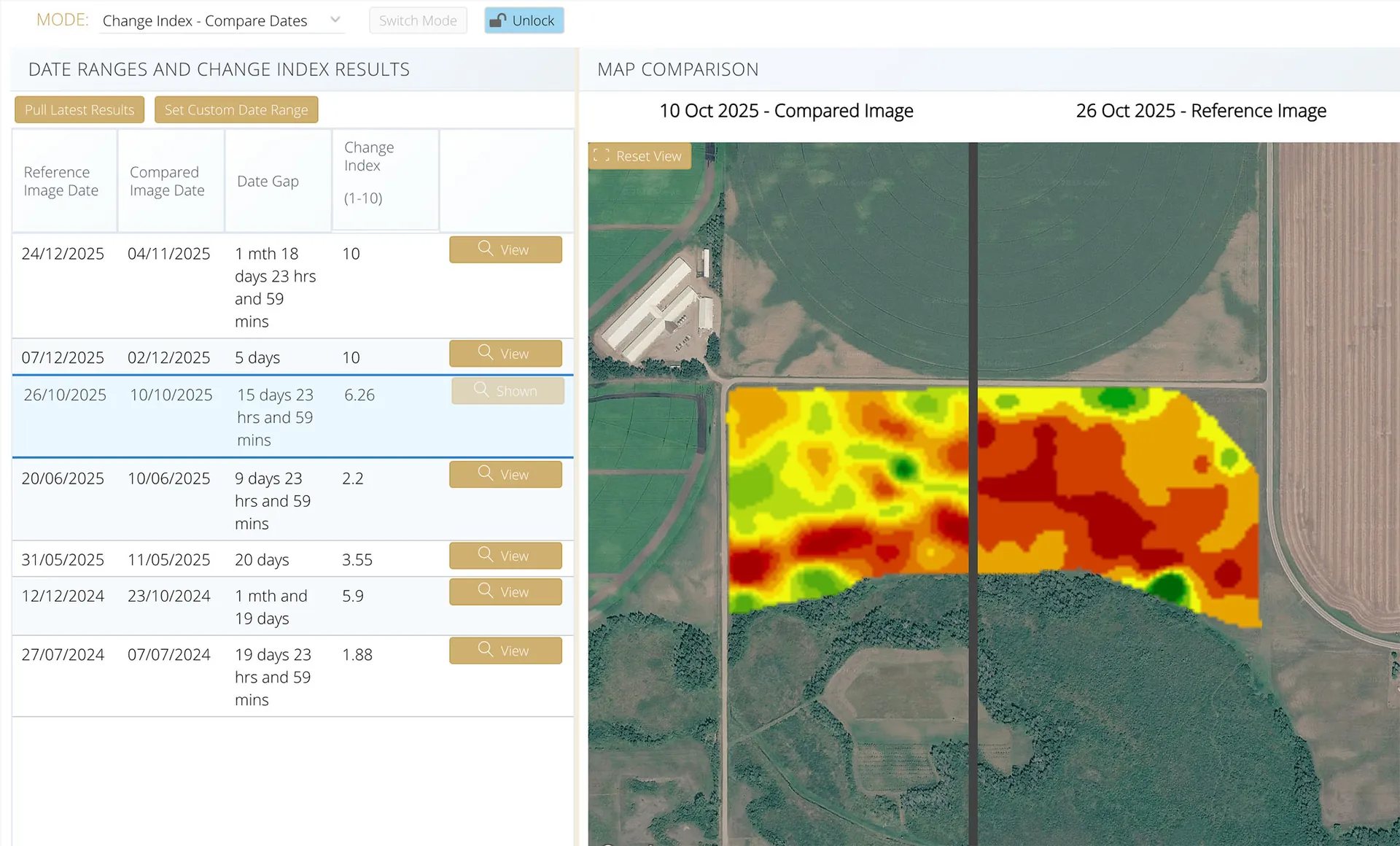
Change Index Scores and Imagery - Helping to highlight issues
Use ranked fields, change maps and scouting recommendations to direct effort where it matters most. This helps teams prioritize agronomy checks, identify issues earlier and improve intervention timing.
Combine seasonal imagery trends with operational records in agCOMMANDER to support planning, cross-season comparisons and communication with managers, advisors and stakeholders.
We can walk through setup options, data availability, and how these analytics fit your existing cropping workflows.